

Assessing landscape scale wildfire exposure
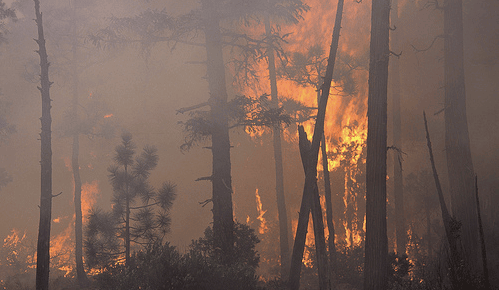
Forest fires are a growing issue in the Mediterranean basin and cause substantial loss to residential structures, infrastructure, industry, farms, vegetation and human life.
The role of humans in the Mediterranean fire regime is readily apparent since almost all ignitions are related to anthropogenic factors. For this reason, fire ignitions in this region have complex spatial and temporal patterns linked to anthropogenic activities.
In a study published on Environmental Management a team of authors (among them, CMCC researchers M. Salis and D. Spano) used a fire simulation modeling approach to assess landscape scale wildfire exposure for highly valued resources on a fire-prone area of 680 km2 located in central Sardinia, Italy.
The abstract of the paper:
We used a fire simulation modeling approach to assess landscape scale wildfire exposure for highly valued resources and assets (HVR) on a fire-prone area of 680 km2 located in central Sardinia, Italy. The study area was affected by several wildfires in the last half century: some large and intense fire events threatened wildland urban interfaces as well as other socioeconomic and cultural values. Historical wildfire and weather data were used to inform wildfire simulations, which were based on the minimum travel time algorithm as implemented in FlamMap. We simulated 90,000 fires that replicated recent large fire events in the area spreading under severe weather conditions to generate detailed maps of wildfire likelihood and intensity. Then, we linked fire modeling outputs to a geospatial risk assessment framework focusing on buffer areas around HVR. The results highlighted a large variation in burn probability and fire intensity in the vicinity of HVRs, and allowed us to identify the areas most exposed to wildfires and thus to a higher potential damage. Fire intensity in the HVR buffers was mainly related to fuel types, while wind direction, topographic features, and historically based ignition pattern were the key factors affecting fire likelihood. The methodology presented in this work can have numerous applications, in the study area and elsewhere, particularly to address and inform fire risk management, landscape planning and people safety on the vicinity of HVRs.
Read the full paper:
Alcasena F. J. , Salis M., Ager A. A. , Arca B., Molina D., Spano D.
Assessing fine scale wildfire exposure for highly valued resources in a Mediterranean area
2015, Environmental Management, DOI: 10.1007/s00267-015-0448-6