

Simulating the weathering and transport of the Mauritius oil spill
When an accident involving oil spill occurs, forecasting the behaviour of the oil slick and understanding in advance where and when it will reach the coastline is crucial to organize an efficient emergency response while limiting severe environmental and economic consequences. After the Wakashio oil spill accident at Mauritius, CMCC Foundation, cmcc srl, in collaboration with Mercator Ocean International, deliver a bulletin modelling and forecasting the oil spill trajectory in the period of interest.
DISCLAIMER – The information and views set out in this Bulletin are those of the authors (CMCC Foundation, cmcc srl and Mercator Ocean International – MOI) and do not necessarily reflect the official opinion of the governments of the area. CMCC Foundation, cmcc srl and MOI do not guarantee the accuracy of the data included in this study. Neither the CMCC Foundation, cmcc srl and MOI nor any person acting on the author’s behalf may be held responsible for the use which may be made of the information contained therein.
Bulletin on the Wakashio oil spill accident – Mauritius –
LAST UPDATE – Date of release: 26/08/2020 – DOWNLOAD THE BULLETIN (pdf)
– Date of release: 25/08/2020 – DOWNLOAD THE BULLETIN (pdf)
– Date of release: 24/08/2020 – DOWNLOAD THE BULLETIN (pdf)
– Date of release: 23/08/2020 – DOWNLOAD THE BULLETIN (pdf)
– Date of release: 22/08/2020 – DOWNLOAD THE BULLETIN (pdf)
– Date of release: 21/08/2020 – DOWNLOAD THE BULLETIN (pdf)
– Date of release: 20/08/2020 – DOWNLOAD THE BULLETIN (pdf)
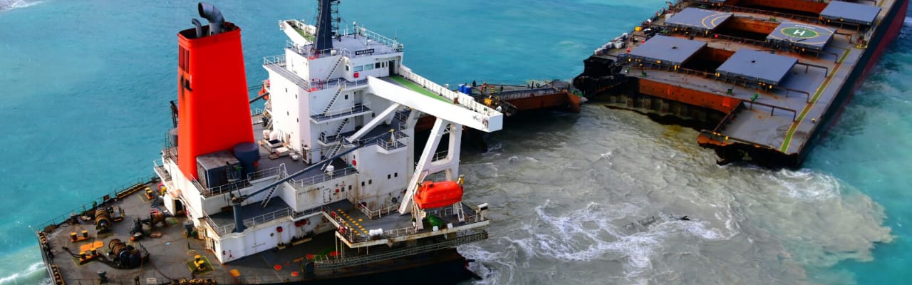
The Japanese MV Wakashio vessel, reported to be carrying nearly 4000 tonnes of oil, ran aground on a coral reef on Mauritius’s southeast coast on 25 July. The grounding event took place in an area of complex coast morphology and bathymetry. Meteo-oceanographic conditions inside the reef are expected to differ from those found offshore. Extensive satellite monitoring of the spill event indicates that most of the leaked oil ended up in the coastal portion of the coral reef.
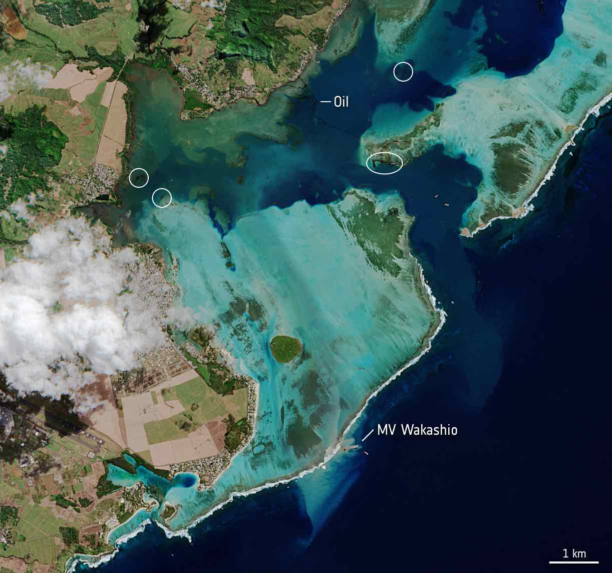
In this image, captured on 11 August by the Copernicus Sentinel-2 mission, the MV Wakashio, visible in the bottom of the image, is stranded close to Pointe d’Esny, an important wetland area. The oil slick can be seen as a thin, black line surrounded by the bright turquoise colours of the Indian Ocean. Oil is visible near the boat, as well as other locations around the lagoon.
Source: ESA
An important part of dealing with the oil spill is understanding where it will move to. Giovanni Coppini, Director of Ocean Predictions and Applications division at CMCC, is an expert in oil spill emergency management at sea and development of environmental and climate change ocean indicators. Using operational oceanography observations, modelling products and climate re-analyses his team has produced one of the first simulations of how the Wakashio spill will spread. “We use Copernicus Marine Service current forecasts and wind forecasts by the ECMWF, using these two ‘forcings’ to simulate the weathering and transport of oil at sea, after which we apply them to our own CMCC Global Oil Spill fate and Trasport model to generate predictions” he explains. “We are looking to demonstrate the European Copernicus Marine Environment Monitoring Service’s ability to provide sea current forecasting models that can be used to forecast oil spills on a global scale.”
This is not the first time that Coppini and the CMCC team has been involved in these kinds of responses to marine environmental emergencies. He was previously head of a JCOMM Expert Team on Marine Environmental Emergencies Response (ETMEER) that sought to develop best practices and coordination in the field. Moreover, CMCC team, provided oil spill forecasting, in collaboration with MONGOOS partners and in collaboration with REMPEC, in many other cases in the Mediterranean Sea in the past including in mapping the oil spill caused by the collision between the Ro-Ro ship Ulysse and CSL Virginia on 7th October 2018 off the coast of Corsica.
On 21 August the Bulletin on the Wakashio oil spill accident was published: “The oil spill trajectory and fate were simulated using the MEDSLIK-II oil spill model coupled with Copernicus Marine Service (CMEMS) oceanographic and ECMWF meteorological products.” However, due to the complexity of the spill scenario, which involves a reef and complex currents that are not covered by CMEMS Global currents fields, only wind forcing was used whereas simulations for areas outside the reef lagoon included current forcings. Comparing the forecast simulation reproducing the spill from 10-16 August against satellite imagery revealed that the MEDSLIK-II simulations were reasonable. Furthermore, the forecast is that the spill will remain as previously simulated and hence “close to the southern coastline of the embayment and in the Blue Bay.” The largest uncertainties about its development stem from fields inside the embayment and the spill rate from the Wakashio shipwreck.