
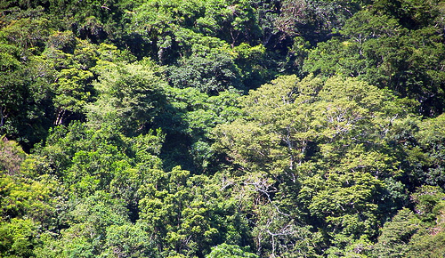
Biodiversity mapping in an African forest
Mapping biological diversity is a fundamental conservation priority as threats from habitat loss, fragmentation and climate change continue to increase. International agreements to reduce biodiversity loss (e.g. the Aichi Biodiversity Targets, CBD 2010) require a basis for prioritizing their response.
The need is particularly great for tropical forests, because they are major repositories of plant diversity and play a critical role in the global carbon cycle and climate change mitigation, as recognized in international processes such as REDD. However, effective large-scale mapping of biodiversity in tropical forests has proven challenging and spatial information about tropical forest biodiversity is scarce.
In a study recently published on PLOS ONE journal, a team of scientists (among them, CMCC researchers G. Vaglio Laurin and R. Valentini from IAFENT Division) explored potential use of airborne hyperspectral data to assess and map plant biodiversity in a West-Africa moist forest in Gola National Park, Sierra Leone.
Results show that airborne hyperspectral sensing can be very effective at mapping canopy tree diversity, making it an effective tool for monitoring forest biodiversity over large geographic scales.
The abstract of the paper:
Tropical forests are major repositories of biodiversity, but are fast disappearing as land is converted to agriculture. Decision-makers need to know which of the remaining forests to prioritize for conservation, but the only spatial information on forest biodiversity has, until recently, come from a sparse network of ground-based plots. Here we explore whether airborne hyperspectral imagery can be used to predict the alpha diversity of upper canopy trees in a West African forest. The abundance of tree species were collected from 64 plots (each 1250 m2 in size) within a Sierra Leonean national park, and Shannon-Wiener biodiversity indices were calculated. An airborne spectrometer measured reflectances of 186 bands in the visible and near-infrared spectral range at 1 m2 resolution. The standard deviations of these reflectance values and their first-order derivatives were calculated for each plot from the c. 1250 pixels of hyperspectral information within them. Shannon-Wiener indices were then predicted from these plot-based reflectance statistics using a machine-learning algorithm (Random Forest). The regression model fitted the data well (pseudo-R2 = 84.9%), and we show that standard deviations of green-band reflectances and infra-red region derivatives had the strongest explanatory powers. Our work shows that airborne hyperspectral sensing can be very effective at mapping canopy tree diversity, because its high spatial resolution allows within-plot heterogeneity in reflectance to be characterized, making it an effective tool for monitoring forest biodiversity over large geographic scales
Read and downlow the full paper:
Vaglio Laurin G., Chan JC-W., Chen Q., Lindsell J. A. , Coomes D. A. , Guerriero L., Del Frate F., Miglietta F., Valentini R.
Biodiversity mapping in a tropical West African forest with airborne hyperspectral data
2014, Plos One 9(6): e97910. DOI:10.1371/journal.pone.0097910
You may also be interested in:
Vaglio Laurin G., Chen Q., Lindsell J. A. , Coomes D. A. , Del Frate F., Guerriero L., Pirotti F., Valentini R.
Above ground biomass estimation in an African tropical forest with lidar and hyperspectral data
2014, ISPRS Journal of Photogrammetry and Remote Sensing, 89 (2014) 49-58