
Discovering the Gulf of Taranto with MREA 2016
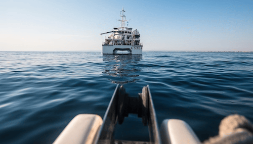
The oceanographic campaign MREA 2016 (Maritime Rapid Environmental Assessment) has just finished. MREA 2016 is a joint initiative of the Italian Navy Hydrographic Institute (Istituto Idrografico della Marina Militare – IIM), coodinator of the different activities, and some Italian research institutes. For approximately two weeks, from June 27th to July 9th, 2016, on board of the hydro-oceanographic ship Aretusa the researchers of some of the most relevant Italian research institutions, such as the CMCC Foundation (Euro-Mediterranean Center on Climate Change), University of Bologna, CNR and INGV, worked together with Naval Officers and experts.
The main objectives of the campaign were to realize an in-depth analysis of sea currents in the Ionian Sea and to provide adequate training for hydrographers to support military operations.
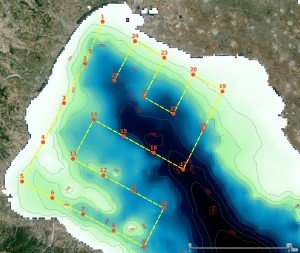
MREA16 Sampling Scheme in the Gulf of Taranto
Designed and coordinated by the Italian Navy Hydrographic Institute, MREA represents a scientific methodology to gather the information on the environmental conditions essential to make decisions quickly and adequately manage the operations at sea. The collected data are required to accurately plan for example an amphibious landing, a situation where it could be crucial to know sea surface currents.
Salinity, temperature, density gradients between different water masses that are responsible for deep currents formation: combining the multi-parameter probe CTD (Conductivity, Temperature and Depth) with the external sensor ADCP (Acoustic Doppler Current Profiler), researchers and Navy personnel acquired data on the thermal structure and physical-chemical properties of the water column to be used for determining sea surface and deep currents and the environmental conditions in the Gulf of Taranto.
The forecasting data obtained by high resolution general circulation models have been compared with current measurements realized with acoustic current profilers in order to validate and improve ocean forecasting models.
MREA 2016 continues and enlarges the previous oceanographic survey MREA 2014 on board of the hydro-oceanographic Navy vessel “Galatea”. The survey was useful to validate the forecasting numerical models of surface and deep ocean currents offshore Taranto. Moreover, the project will realize repeated measurements in the same area in different seasons in order to improve and calibrate the oceanographic forecasting modelling while taking into account sea seasonal variability.