




New satellite-based tool maps greenhouse gas emissions from forest fires
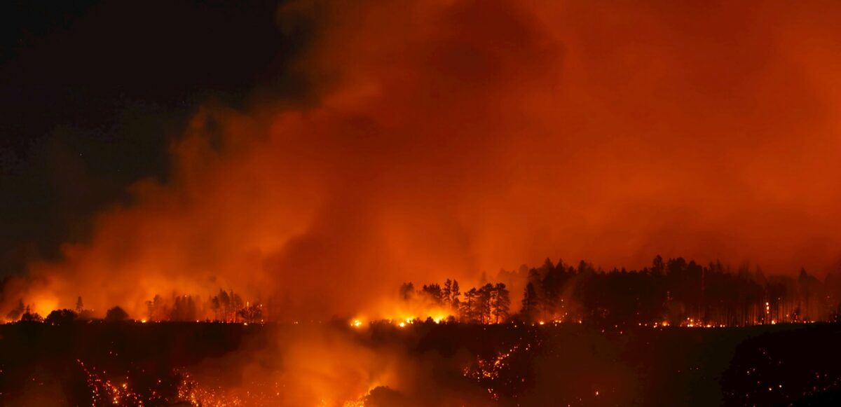
Wildfires are becoming a regular feature, yet their greenhouse gas emissions are still hard to measure accurately. A new CMCC-led study presents FIRE-TRACE, a satellite-based framework that allows users to estimate their impacts at national, regional, and even municipal scales and improves how countries monitor and report emissions from forest fires, helping to close a key gap in global climate action.
Every year, millions of hectares of forest burn worldwide, releasing large amounts of greenhouse gases into the atmosphere and contributing to climate change. These fires threaten people’s health, damage homes and infrastructure, and alter the global carbon cycle, yet emissions from forest fires remain difficult to estimate with precision.
Although countries are required to report their greenhouse gas emissions, including those from wildfires, they often use different methods which makes it hard to compare results. The Intergovernmental Panel on Climate Change (IPCC) offers guidance ranging from Tier 1, the simplest method using global or regional averages, to Tier 3, which relies on country‑specific data and more sophisticated models. Many fire‑prone countries, including those in southern Europe, still rely on lower‑tier approaches because the detailed data needed for Tier 3 are not always available or easy to use.
Forest fires account for only a small share of global burned area – about 5% – but they are responsible for roughly 18% of global carbon dioxide emissions from fires and around 20% of carbon monoxide, underscoring their disproportionate impact on the climate system. These emissions are particularly important for tracking progress towards Sustainable Development Goals that call for accurate measurement and monitoring to inform timely mitigation strategies.
Introducing FIRE-TRACE
In the study, An Earth Observation‑based Tier 3 framework for monitoring greenhouse gas emissions from forest fires in Italy, published in Scientific Reports, CMCC researchers present FIRE‑TRACE: the Forest fIRe framEwork for Tier 3 Reporting and Accounting of Country‑level Emissions. Led by CMCC researcher Chiara Aquino, the work integrates satellite observations with field‑based biomass measurements to improve estimates of burned area, fuel load, and fire emissions, advancing national reporting from Tier 1 or 2 toward Tier 3.
FIRE‑TRACE adds satellite data directly into the IPCC methodology, making it possible to estimate forest fire emissions in a consistent way across countries and regions. “We use Italy as an example, but the methodology is modular and can be applied to any country,” says Aquino. “Because satellite data are collected using the same methods worldwide, they provide results that are more consistent and comparable than those based only on national inventories.”
Unlike many existing national inventories and global satellite products, which report emissions at a broader scale or only as national totals, FIRE‑TRACE resolves burned area and fire severity at the scale of individual fires.
“This makes it possible to identify where fires are happening, providing information for forest management and climate change mitigation,” says CMCC researcher and co-author of the study Manuela Balzarolo. “FIRETRACE is an excellent example demonstrating how to make Earth observation information more accessible and actionable for policy and reporting agencies in near real time. It is also a good example of co‑designing with users – including public authorities, researchers, and environmental agencies – to ensure usability and relevance in decision‑making contexts.”
From national totals to maps and metrics
One of the main strengths of FIRE‑TRACE is that it does not only estimate how much greenhouse gas is released by forest fires, but also where those emissions occur. The framework links satellite‑derived burned area and fire severity with country‑specific data from the National Forest Inventory. This makes it possible to calculate how much biomass is actually consumed in different forest types and locations, rather than assuming a single average combustion factor for large areas.
Between 2018 and 2023, the study finds that an average of 109 square kilometres of forest burned every year in Italy – an area equivalent to around 15,000 football pitches. The greenhouse gases released by these fires were comparable to the annual emissions of about 730,000 passenger cars, illustrating the scale of the problem.
FIRE‑TRACE also shows how wildfire emissions vary across the country and how they change over time: during the study period, the highest emissions came from Calabria and Sicily, where large wildfires occur frequently, while Tuscany ranked third, mainly because of the exceptionally severe wildfire season in 2022.
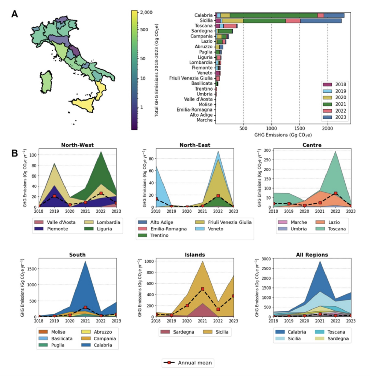
Detailed maps allow users to examine how emissions differ between Mediterranean evergreen forests and other forest categories, or compare trends between regions with different fire regimes. This richer picture of where and how emissions are generated supports more targeted strategies for prevention, adaptation, and mitigation. Source: Aquino et al., 2026.
“This research shows that it is possible to build a bridge between science and policy, creating something that is simple, automatic, and usable in practice,” says Aquino.
Greenhouse gas emissions from wildfires remain one of the largest sources of uncertainty in the global carbon cycle. While satellite data used to detect burned areas have become increasingly advanced, models still need improvement. Key challenges remain in refining combustion parameters by using more diverse datasets, and improving measurements of available forest biomass, which is still a parameter prone to large errors.
Addressing these issues is only possible through international and multidisciplinary collaboration, including targeted field campaigns and the sharing of information across institutions, for example, laboratory measurements of emission factors. “This research is not an endpoint, but rather a starting point, which is what makes this research particularly exciting,” concludes Aquino.
For more information
Aquino, C., Bacciu, V., Chiriacò, M.V. et al. An Earth Observation-based Tier 3 framework for monitoring greenhouse gas emissions from forest fires in Italy. Sci Rep (2026). https://doi.org/10.1038/s41598-026-55318-x
The FIRE‑TRACE platform is accessible online here.