
Oil Spill in Syria: how is it moving. Read the bulletin and watch the video
On August 24, an oil spill on the coast of Syria was imaged by the Copernicus Sentinel-1 satellites.
CMCC, ORBITALEOS and ORION are collaborating to support REMPEC, the Regional Marine Pollution Emergency Response Centre for the Mediterranean Sea, for the detection, simulation and prediction of the movement of the Oil Spill.
Since the beginning of the crisis, the team analysed 8 satellite images and run daily forecasting models, by using Ocean forecasting systems that are based on Mediterranean Monitoring and Forecasting Copernicus Marine Service (lead by CMCC) and CYCOFOS high-resolution system (lead by Orion).
After drifting to the North, affecting the coastline of Syria, the oil spill reached Latakia cape (August 27-28) and turned to West. At this point a big part of it drifted in open Ocean.
The next day (August 29), much of the oil spill was detected moving toward Cyprus (see pictures in the report).
- See the full report (pdf) – The report is produced by the new system call OKEANOS (by CMCC&Orbital EOS) that integrates remote sensing analytics (Orbital EOS) and oil spill forecasting (CMCC & ORION) associated with the spill detected
- The CMCC Mediterranean Forecasting System
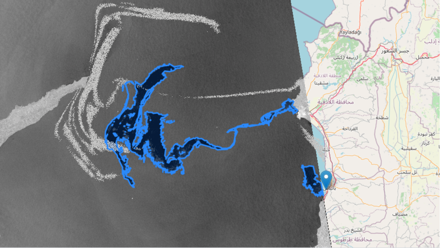
In the picture at the top of this page: the blue polygon shows the extension of the oil spill detected from Copernicus Sentinel-1 satellite at 2021-08-29 15:41 UTC. The grey area shows the oil spill forecast produced by CMCC using MEDSLIK-II forced with Copernicus Marine Service currents and ECMWF winds.