
Landslides and climate change: how to assess future impacts
Over the past years, pyroclastic covers mantling slopes in the Campania Region of Southern Italy have frequently been affected by landslides. The Campania region shows in fact one of the highest mortality / injury rates due to landslides, with the dramatic event in Sarno in 1998 (160 victims).
Due to high exposure and demographic pressure in the affected areas, assessment of the potential effects of climate change on the frequency of such events has become a crucial issue.
In this perspective, in the last years REMHI Division has deeply investigated such topic within different research projects (e.g. SAFELAND, INTACT, GEMINA) using different methodologies and approaches (laboratory tests, field monitoring, numerical analysis).
To this aim, different simulation chains have been developed and tested. They differ from each other for (i) climate models involved, (ii) impact tools (rainfall thresholds, statistical methods or physically based models – to take into account other dynamics such as evaporation, infiltration, soil water content etc -) and (iii) approaches attempting to “bridge the gap” between the previous ones (e.g. adopting or not bias correction approaches).
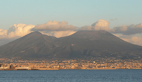
An analysis recently published on Procedia Earth and Planetary Science (among the authors, researchers G. Rianna, P. Mercogliano and A. Reder of REMHI Division) focused in particular on the case study of Nocera Inferiore, a town of the Campania region located at the base of the Lattari Mountains.
Watch the video:
Its slopes are covered by pyroclastic deposits resulting from several eruptions of Somma-Vesuvius over the last 10,000 years that have been historically affected by slope instability phenomena, which caused remarkable economic damages and, in some cases, fatalities. Climate change is expected to exacerbate these phenomena.The concurrent expected increase in urbanization and then in exposed assets entails that the development of adequate adaptation strategies (in terms of land use planning or disaster management) represents a crucial issue for the area.
A modeling chain was in particular developed for the evaluation of potential variations of occurrences of landslide events under the effect of climate changes. The study highlights potential variations (increases) in triggering frequency under the effect of different concentration scenarios and time horizons.
For further information:
Read the full paper
The Global Circulation Model CMCC-CM (horizontal resolution 80 km) used in the climate simulation chain of the study
The Regional Climate Model COSMO-CLM (horizontal resolution 8 km) used in the climate simulation chain of the study in order to dynamically downscaled the global circulation model.
The INTACT project
The page of the SAFELAND project